About Weather4Fly
Advanced Weather Intelligence for Drone Pilots
Weather4Fly was created by drone enthusiasts for drone enthusiasts. We understand the unique challenges pilots face and have built a comprehensive solution that goes far beyond generic weather apps.
Our Mission
To provide drone pilots with the most accurate, comprehensive, and easy-to-understand weather intelligence available, enabling safer flights and better decision-making in the field.
We believe that every pilot deserves access to professional-grade weather data that's specifically tailored for drone operations, not just general aviation or consumer weather apps.

Why Weather4Fly is Different
Intelligent Assessment Algorithm
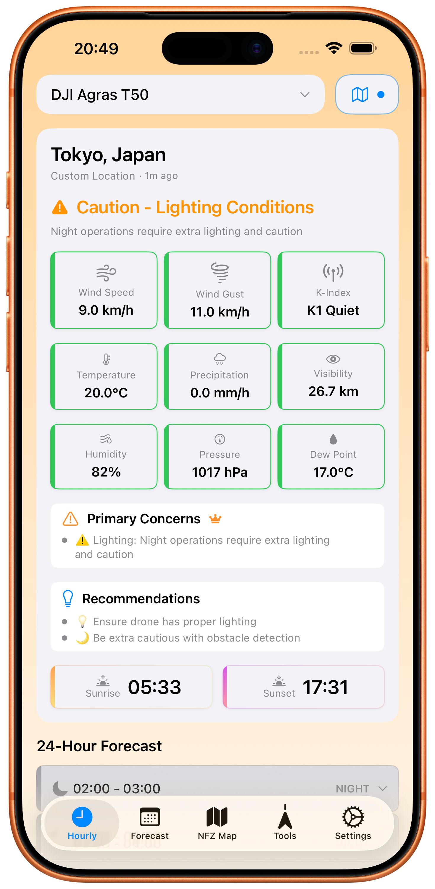
Our proprietary flight safety algorithm analyzes multiple weather parameters simultaneously, considering your specific drone's capabilities and limitations. Unlike generic weather apps, we provide drone-specific recommendations based on weight, size, and weather resistance.
- Multi-parameter safety analysis
- Drone-specific thresholds
- Real-time risk assessment
- Detailed explanations for decisions
Precision Weather Data
We integrate multiple professional weather data sources including WeatherKit and NOAA to provide the most accurate conditions for your exact location. Our system tracks geomagnetic activity (K-index) that affects GPS reliability - critical for drone navigation.
- Multiple weather data sources
- High-resolution location accuracy
- K-index geomagnetic monitoring
- Real-time updates
Comprehensive Drone Support
From ultra-light consumer drones to heavy agricultural and industrial platforms, Weather4Fly supports 64+ drone models with specific flight parameters. Each drone profile includes detailed specifications for accurate flight condition assessment.
- Consumer drones (DJI, Autel, etc.)
- Professional cinematography drones
- Agricultural spraying systems
- Industrial inspection drones
Professional Flight Tools
Beyond weather, Weather4Fly includes professional-grade flight tools like NFZ mapping, GPS satellite tracking, compass navigation, and airspace intelligence. Everything you need for safe, compliant drone operations.
- No-fly zone mapping
- GPS satellite constellation
- Airspace restrictions
- Flight planning tools
Built with Cutting-Edge Technology
Native iOS
Built specifically for iOS using SwiftUI for optimal performance and seamless integration with Apple's ecosystem.
WeatherKit API
Leverages Apple's professional weather data service for highly accurate, location-specific weather information.
NOAA Integration
Integrates with NOAA's Space Weather Prediction Center for real-time geomagnetic activity monitoring.
Privacy First
No data collection, no tracking, no cloud storage. All data processing happens locally on your device.
Frequently Asked Questions
How accurate is Weather4Fly's weather data?
Weather4Fly uses professional-grade weather data from Apple's WeatherKit service, which sources data from multiple meteorological agencies. We provide location-specific forecasts with high spatial and temporal resolution for maximum accuracy.
What makes Weather4Fly different from other weather apps?
Weather4Fly is specifically designed for drone operations. Our intelligent assessment algorithm considers your drone's specific capabilities, weight, and weather resistance to provide personalized flight recommendations that generic weather apps cannot offer.
Do you support my drone model?
We support 64+ drone models including popular consumer brands (DJI, Autel, Parrot), professional cinematography drones, agricultural platforms (DJI Agras, XAG), and industrial inspection drones. If your model isn't listed, you can use our generic drone profile.
How does the K-index monitoring work?
K-index measures geomagnetic activity that can interfere with GPS signals. Weather4Fly monitors real-time K-index data from NOAA and alerts you when conditions might affect GPS reliability, helping prevent navigation issues during flight.
Is my location data private?
Absolutely. Weather4Fly processes all location data locally on your device. We never collect, store, or transmit your location information to our servers. Your privacy is our top priority.
What's included in the premium version?
Premium includes 24-hour forecasts (vs 4-hour free), 5-day extended forecasts, detailed flight analysis with specific concerns and recommendations, global location search, NFZ mapping, and advanced flight tools.
Can I use Weather4Fly for commercial operations?
Yes! Weather4Fly is designed for both recreational and commercial drone operations. Our professional features like detailed weather analysis, NFZ mapping, and comprehensive drone database make it ideal for commercial pilots.
How often is the weather data updated?
Weather data is updated in real-time as conditions change. We implement intelligent caching to balance freshness with performance, ensuring you always have the most current information while minimizing battery usage.
Built by Pilots, for Pilots
Weather4Fly is developed by a passionate team of drone pilots and software engineers who understand the real-world challenges of flight planning and safety assessment. We use our own app for every flight and continuously improve it based on real pilot feedback.
Pilot-Centric Design
Every feature is designed from a pilot's perspective, focusing on practical usability in the field.
Data-Driven Decisions
Our algorithms are based on meteorological science and real-world flight experience data.
Continuous Improvement
We regularly update our database, algorithms, and features based on user feedback and industry changes.
Ready to Fly Smarter?
Join thousands of pilots who trust Weather4Fly for safer, more informed drone operations.